Settlement Plate
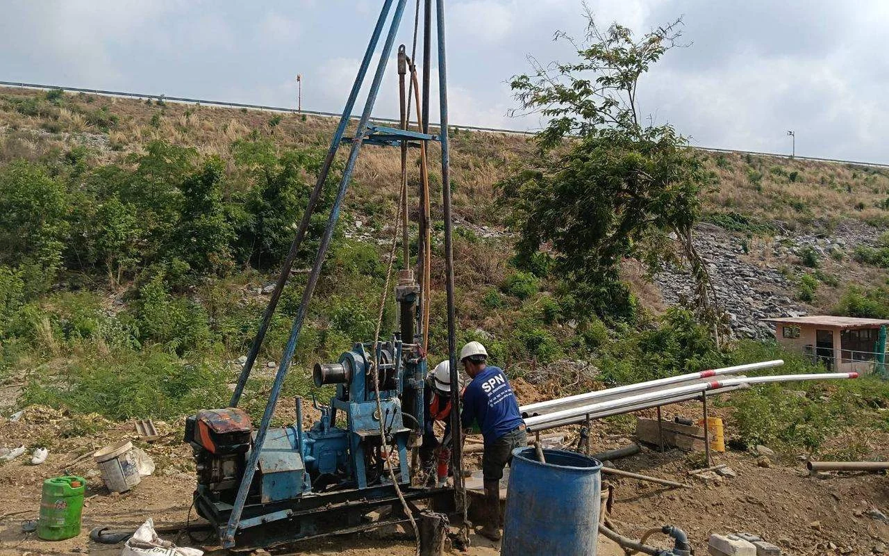
Settlement plate under fill
A 60×60 cm steel plate placed at the base of the fill, with a steel rod extended above the surface; levels read with an Auto Level every round
How it is monitored →SPN's instrumentation service covers settlement, groundwater pressure, lateral movement and structural loads through to adjacent building and vibration monitoring. We handle everything from installation and scheduled or real-time readings via Datalogger to trend reports signed by a COE-licensed engineer
Geotechnical Instrumentation is equipment that detects changes in soil and structures that cannot be seen by eye. Settlement Plates measure settlement, Inclinometers measure lateral movement and Piezometers measure pore water pressure. This continuous data lets engineers slow down or adjust construction methods before real damage occurs
Settlement Plates, Deep / Multi-level Settlement Points, Surface Settlement Markers and Extensometers track settlement from the ground surface to deep soil layers, to verify the design and the progress of consolidation
A 60×60 cm steel plate placed at the base of the fill, with a steel rod extended above the surface; levels read with an Auto Level every round
How it is monitored →Anchors set at several depths to show which soil layer settles the most
Bang Na case study →Markers on the ground, roads and sidewalks around the excavation, read against benchmarks outside the zone of influence
Plan deep excavation monitoring →Rod Extensometers anchor rods at several depths; Magnetic Extensometers use magnetic rings around a pipe, read with a probe
Standpipe Piezometers, Vibrating Wire Piezometers and Observation Wells measure pore water pressure and groundwater level to assess stability and the effects of drainage
Tip set in a filter sand zone, sealed above with Bentonite, water level read with a Water Level Meter; low cost, suitable for long-term use
Standpipe vs Vibrating Wire →Fast response, high resolution, can connect to a Datalogger for automatic readings; every sensor is acceptance-tested before installation
Samut Prakan case study →Slotted pipe across the aquifer, used to track seasonal water levels and the effects of dewatering during construction
How to install and read →Inclinometers, Tiltmeters and Total Station / Prism Monitoring detect movement of soil, retaining walls and structures before damage occurs
A probe is lowered into an Inclinometer casing installed in soil or a wall, tilt read every 0.5 m, then the displacement profile is calculated over the full depth
Principles and reading results →Installed on columns, walls or retaining walls; read with a portable readout or connected to a Datalogger for real-time alarms
Point layout and alarm criteria →Prism targets fixed on buildings, walls or key structures, sighted with a Total Station from benchmarks to get X-Y-Z movement
SPN surveying services →Strain Gauges, Load Cells, Earth Pressure Cells and Instrumented Piles measure the actual forces in struts, ground anchors, walls and piles for comparison with design values
Welded or embedded on struts, rebar or concrete; strain converted to force using section properties
Converting strain to force →Installed between the strut end and the waler or under the Ground Anchor head; force read directly without section conversion
A fluid-filled cell connected to a pressure transducer, set on the wall face or under a footing to measure actual total earth pressure
Strain Gauges at several levels and Telltales in a static load test pile, separating skin friction in each soil layer from end bearing
Test details →Carry out a Pre-construction Condition Survey to record existing conditions before work starts, then monitor Building Settlement Points, Crack Meters and Vibration during construction to reduce damage and disputes with neighbors
Photos, video and records of the location and size of existing cracks in buildings around the project, before piling, excavation or demolition
Survey procedure →Markers on columns or walls of adjacent buildings, levels read with an Auto Level against benchmarks to assess differential settlement
Settlement Point and Tiltmeter →Installed across key cracks, read manually (Crack Gauge) or Vibrating Wire type connected to a Datalogger, to see whether cracks are still widening
Which cracks are dangerous? →3-axis Geophones on adjacent building foundations record PPV continuously during piling, demolition or compaction, compared with the National Environment Board Notification No. 37 (B.E. 2553 (2010)) criteria
How vibration is monitored →An Automatic Datalogger reads many instrument types at once, 24 hours a day, sends a Real-time Alert as soon as a reading exceeds its criteria, and displays results on a Cloud Dashboard with reports
Records every 1 minute to daily, supports Vibrating Wire, 4-20mA and RS-485 instruments, transmits data via 4G/WiFi
Multiple alarm levels, instant alerts by LINE, SMS or Email when any reading reaches its set limit
The project team can view charts from anywhere at the same time; PDF/Excel reports exported on schedule
Manual vs Automatic Monitoring →Send the construction drawings, site plan or specifications (Spec / TOR / EIA conditions). SPN engineers will propose instrument types, locations and reading frequency, with a quotation within 24 hours


Case studies published on our website (charts in the articles illustrate principles and are not actual monitoring data)
Inclinometer casing installed in a borehole behind the sheet pile line, read throughout excavation to track lateral soil movement
Deep Settlement Points installed in borehole BH-DSP measure soil settlement at several depths, showing which layer settles most — unlike a Settlement Plate, which measures only at the surface
Standpipe Piezometer with its tip at 8 m depth, paired with a Monitoring Well in soft clay, read monthly to track groundwater level and pore water pressure in the soil
Borehole BH-1 drilled, Inclinometer casing installed and baseline read, to find whether the slope is moving and at what depth, in hillside colluvium over weathered rock

From planning monitoring points to the interpreted report — see which projects need a monitoring plan in When is instrumentation required?
Construction drawings, site plan, soil investigation results and monitoring requirements (Spec / TOR / EIA conditions) by LINE or email
Our engineers propose instrument types, number of points, depths and reading frequency together with the designer, with a quotation
Drill and install at approved locations, recording the actual coordinates, elevation and depth of every instrument
Readings taken several times before construction starts until stable, used as the reference for all changes
Daily, weekly or monthly readings as planned, or via Datalogger with alarms when readings reach criteria
Periodic reports with trend charts compared with alarm criteria, plus a final summary report at completion, signed by an engineer
Criteria for each level are set by the project designer or consultant. SPN sets the criteria in the system and reports immediately when readings reach them
Readings below the alert level; work and readings continue on the normal schedule
Increase reading frequency, inspect the site and notify the supervising engineer and designer
Stop or change construction methods and agree remedial measures with the designer
SPN Soil Engineering installs and reads a full range of instruments that monitor soil and structural behavior, from Settlement Plates, Piezometers and Inclinometers to automatic real-time Datalogger systems, for construction that needs continuous stability monitoring such as deep excavations, embankments and projects with EIA reporting, nationwide across Thailand. See real installation case studies: Inclinometer, deep excavation in Bang Phli · Deep Settlement Point, Bang Na · Piezometer and Monitoring Well, Samut Prakan · Inclinometer, Kraseaw Hydropower slope. For an overview before choosing, read Geotechnical Instrumentation: what it is and 10 types used in practice. Installation follows ASTM D6230 (Inclinometer) and ASTM D7764 (Vibrating Wire Piezometer), and vibration monitoring is compared with the National Environment Board Notification No. 37 (B.E. 2553 (2010)) and DIN 4150-3. The work is carried out by the same engineering team as SPN's soil investigation
Tracks settlement of soil and structures from the surface to deep soil layers, to verify the design and assess the progress of consolidation
Continuous monitoring of pore water pressure and groundwater level to assess stability and drainage performance
Measures tilt and lateral movement of soil and structures, giving warning before collapse or damage
Measures the actual forces in struts, ground anchors, walls and piles for comparison with design values
Records existing conditions before work starts and measures impacts during construction to reduce damage and disputes
Automatic data logging and mobile alerts when readings exceed set limits (compared with readings by field staff: Manual vs Automatic Monitoring)
← Scroll to see the full table →
| Instrument | Measurement | Accuracy (typical) | Datalogger support | Applications |
|---|---|---|---|---|
| Settlement Plate | Settlement under fill | ±1 mm | No (read with Auto Level) | Embankments, Preloading |
| Multi-level Settlement | Settlement by layer | ±1 mm | Yes (VW Sensor) | Consolidation analysis |
| Standpipe Piezometer | Water pressure at a point | ±10 mm | Yes (Pressure Transducer) | EIA, long-term |
| Vibrating Wire Piezometer | Pore water pressure | ±0.1 kPa | Yes (VW Datalogger) | Excavation, Preloading |
| Observation Well | Overall groundwater level | ±10 mm | Yes (Diver Logger) | EIA, Environmental |
| Inclinometer | Lateral movement | ±0.1 mm/m | Yes (In-place Inclinometer) | Excavation, retaining walls |
| Tiltmeter | Structural tilt | ±0.01° | Yes (Wireless) | Real-time Alert |
| Strain Gauge | Steel strain | ±1 με | Yes (VW Datalogger) | Strut, Anchor, Pile |
| Extensometer | Settlement/heave with depth | ±1 mm (Magnetic) · ±0.1 mm (Rod) | Yes (Rod + Transducer) | Excavation base, high embankments |
| Total Station / Prism | 3D movement | mm level (depends on sight distance) | Scheduled readings | Buildings, retaining walls |
| Load Cell | Strut/anchor force | Approx. ±0.5% of range | Yes (VW Datalogger) | Strut, Ground Anchor |
| Earth Pressure Cell | Total earth pressure | Approx. ±0.1–0.5% of range | Yes (VW Datalogger) | Retaining walls, under footings |
| Instrumented Pile | Load distribution in piles | ±1 με (VW Strain Gauge) | Yes (VW Datalogger) | Static Load Test |
| Building Settlement Point | Building settlement | ±1 mm | No (read with Auto Level) | Adjacent buildings |
| Crack Meter | Crack width | 0.01–0.1 mm | Yes (VW Crack Meter) | Buildings with existing cracks |
| Vibration Monitor | PPV and frequency | Finer than 0.1 mm/s | Yes (continuous recording) | Piling, demolition |
Criteria for deciding whether a project needs a monitoring plan, and when to start baseline readings, are in When is instrumentation required?
Geotechnical Instrumentation is the installation of instruments that measure soil and structural behavior to monitor settlement, pore water pressure and lateral movement. The data helps verify the design, gives early warning and supports EIA reports
A Settlement Plate is a 60×60 cm steel plate placed on the original ground before filling, with a steel rod extended above the fill. It measures settlement of the original ground under embankments, roads and Preloading projects that accelerate consolidation of soft soil. Levels are read with an Auto Level every round
A Piezometer measures Pore Water Pressure at a specific depth. Types include Standpipe (low cost) and Vibrating Wire (high accuracy, Datalogger-compatible). An Observation Well measures the overall groundwater level of a soil layer and suits long-term monitoring and EIA work
An Inclinometer measures tilt and lateral movement with depth. A probe is lowered into an ABS casing installed in the ground, tilt is recorded every 0.5 m, and the displacement profile of the whole column is calculated, giving warning before failure
Vibrating Wire offers high accuracy and fast response, can measure continuously and automatically via a Datalogger, and alarms when readings exceed a threshold. A Standpipe costs less but is normally read by hand (a Pressure Transducer can be added for automatic readings) and responds more slowly in clay because water must flow in and out of the pipe (Time Lag)
A Datalogger records readings automatically at set intervals and sends data via 4G/WiFi to a Cloud Server. Thresholds trigger automatic SMS/Line/Email alerts when readings exceed safe limits. It supports several instrument types at once
Yes. SPN takes readings on schedule (daily, weekly, monthly) and provides trend chart reports, engineering interpretation and recommendations, delivered as PDF and Excel
They should be installed before construction starts to record Baseline data on soil and groundwater under normal conditions, then monitored continuously during and after construction to compare changes and make informed project decisions
ASTM D6230 for movement monitoring with Inclinometers and ASTM D7764 for acceptance testing of Vibrating Wire Piezometers before installation, together with the instrument manufacturer's manuals. Vibration monitoring is compared with the National Environment Board Notification No. 37 (B.E. 2553 (2010)) or DIN 4150-3 as the project specifies, and instrumented piles are static load tested to ASTM D1143. Work is supervised and results certified by a COE-licensed civil engineer
SPN installs 3-axis Geophones on the foundation or structure of adjacent buildings, records peak particle velocity (PPV, mm/s) with frequency, and compares it with the National Environment Board Notification No. 37 (B.E. 2553 (2010)) or DIN 4150-3 / BS 7385-2 as the project specification requires
It should be done before piling, excavation or demolition starts: photos, video and records of the location, length and width of existing cracks, with a report and survey point plan. It serves as evidence to compare with post-construction conditions and helps reduce disputes with neighbors
A Load Cell measures force directly, installed between the strut end and the waler or under the Ground Anchor head. A Strain Gauge measures strain on the member surface, converted to force using the cross-sectional area and material modulus; several are usually installed around the section to get the average force. Both can be used together as a cross-check
An Instrumented Pile is a test pile fitted with Strain Gauges at several levels and Telltales during manufacture or before concreting. When static load tested to ASTM D1143 it gives the load distribution along the pile, separating skin friction in each soil layer from end bearing, while a normal test only gives the load-settlement curve at the pile head
Price depends on instrument type, number of points, depth, site conditions and reading frequency/monitoring period. Contact us for a free quotation at +66 64 746 9601; our engineers reply within 24 hours